In case of a major earthquake, these 6 biggest cities on the San Andreas Fault Line hold the biggest potential for human casualties.
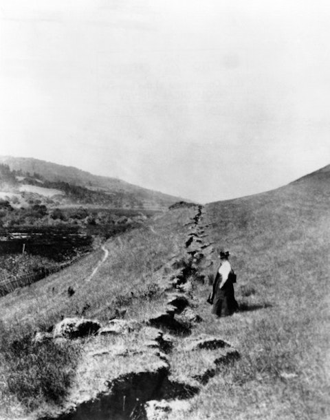
San Andreas is among the biggest fault lines in the world. Its correct name is San Andreas Fault System and it stretches for some 1,300 kilometers. It starts near the Salton Sea and ends Mendocino coast. The system consists of three parts, Northern, Central, and Southern. Part of the Southern fault zone is San Jacinto Fault, considered a branch of the main fault line. Due to its position cutting California from the north to the south and passing through some of the most heavily populated and developed parts on the planet, it has the most destructive potential of all fault lines.

Everett Historical/Shutterstock.com
If a major earthquake hits, these 6 biggest cities on the San Andreas Fault line won’t be the only ones to feel it. Depending on the location of the quake, every city in the area will suffer major destruction. Even if direct damage is avoided, the consequences will be disastrous. For instance, 70% of Southern California’s water supply comes from the areas north of San Andreas Fault Line. Supplying drinking water alone to more than 20 million people will be a logistical nightmare, not to mention food, medicine, and other emergency supplies.
Unfortunately, the San Andreas Fault Line isn’t the only fault that threatens California. Newport-Inglewood Fault Zone has a potential of completely destroying Los Angeles area. The last time it was activated was in 1933, causing the Long Beach earthquake, the second deadliest earthquake in California. The death toll was only surpassed by the 1906 San Francisco earthquake. The second biggest city in the Golden State, San Diego, is in danger from several faults that pass nearby, like Elsinore Fault. Even though the mountains would serve as a shield, the consequences would be devastating.
Neither Sand Diego nor Los Angeles is on our list, though. In this article, we focus on the biggest cities on the Sand Andreas Fault Line and neither of those two are located on it. The cities on the list are ranked according to their population, taken from the United States Census Bureau estimates for 2014. The population seems like an appropriate metrics for this list, as it illustrates how many people are in danger when the big one strikes.


